


Magnitude 7.3 earthquake in the Shumagin Gap, Alaska
Another exciting strike-slip earthquake in a classic subduction setting


Earthquake Insights is an ad-free newsletter written by two independent earthquake scientists. Our posts are written for a general audience, with some advanced science thrown in! To get these posts delivered by email, become a free subscriber. If you would like to support our work here, please also consider a paid subscription. If you use our Substack as part of a group, or for teaching, consider a teaching or institutional subscription. Every paid subscription makes a difference!
If you have recently lost your job or are a student or researcher without ability to pay, let us know and we will upgrade your subscription to “paid” at no cost.
See the Alaska Earthquake Center report on the earthquake here.
At 12:37 PM local time on July 16, 2025, a magnitude 7.3 earthquake occurred off the southern coast of Alaska. A seismometer on Chernabura Island, 67 kilometers to the northeast, recorded intensity VI shaking (strong). The closest population center to the earthquake is the city of Sand Point, population ~600 (near Unga on the map below); here, shaking should have also been about intensity VI. Most people in Anchorage, ~950 kilometers to the northeast, did not feel the earthquake.

Although this shaking should not have been enough to cause serious damage, the earthquake also triggered a tsunami warning, later downgraded to an advisory, and then canceled. A submarine M7.3 earthquake is strong enough to possibly trigger a locally damaging tsunami, but the actual wave heights depend on the details of the rupture and the local bathymetry (seafloor topography). In order to provide as much warning time as possible, the tsunami warning system immediately alerts if a tsunami is at all possible, and then adjusts the warning as data arrive that better constrain the situation. In this case, a tsunami was in fact observed, but with a height of only ~6 centimeters (at Sand Point).
The recent earthquake occurred within the Shumagin Gap, an area that has long been noted for its apparently unusual earthquake behaviors. Having hosted six earthquakes above M7 since 2020, the Shumagin Gap continues to attract a lot of scientific interest. On a side note, the gap is named after the nearby Shumagin Islands, which themselves bear the name of an unlucky sailor, Nikita Shumagin, who died of scurvy in 1741 and was buried on one of the islands.

Coincidentally, we last wrote about earthquakes in this area two years ago, (almost to the day) following a M7.2 earthquake caused by slip on the subduction megathrust!
Great Alaskan-Aleutian earthquakes
Of the world’s thirteen largest recorded earthquakes, four of them have occurred along the subduction zone that borders the southern side of Alaska and the Aleutian Islands. These earthquakes all occurred within a twenty year span, between 1946 and 1965. While seismograph records do exist for these earthquakes, they largely predated the development of global seismic networks, and some significant mysteries about these events remain.

Added together, and combined with a few smaller (but still big) ones, these rupture areas indicate that the vast majority of the subduction zone has slipped within the last century. That’s pretty unusual for such a large subduction system.
But, not all of the megathrust has slipped so recently! As scientists mapped out the extents of these ruptures, they noticed that several parts of the megathrust had been left out. These “gaps” between rupture patches have attracted almost as much interest as the earthquakes themselves. The key question: why haven’t these areas slipped, even though so much new stress was added by the neighboring ruptures? Asking this question yields a whole host of other questions:
How confident are we that these gaps exist at all — do we know for sure how far those other ruptures extended?
Is there a fundamental difference to these parts of the megathrust that stopped nearby ruptures, like geometric barriers, special frictional properties of the fault, or other geological reasons?
Are these gaps places where we should rarely expect earthquakes, because the stress is released by aseismic creep? Or are they places where we should expect more earthquakes, because the fault is stressed by neighboring ruptures but cannot ever experience very large slips?
Tied into these questions are the variations in the great earthquakes themselves. The magnitudes of the earthquakes in 1946 and 1957 — M8.6 and M8.7 — are very similar. But the mapped extent of the 1946 is much, much smaller! This difference is balanced by the amount of actual slip in the two events: Tape and Lomax (2022) estimated that the 1957 earthquake slipped an average of ~2.0 meters on a fault ~1230 kilometers long, while the 1946 earthquake slipped more than six times as much (12.7 m), on a fault about one-sixth that length (199 km).
Notably, the 1946 earthquake raised a locally huge tsunami that caused immense near-field damage, in addition to a transoceanic disaster. We now believe that the transoceanic waves were raised by the fault slip, but that a submarine landslide caused the locally huge inundations. The 1946 earthquake was also one of the slowest recorded earthquake ruptures — propagating at a little over 1 kilometer per second. That explains why the rupture patch is so small for the large magnitude: it’s the opposite case of the recent M7.7 earthquake in Myanmar that rupture for about 550 kilometers, at rupture speeds of over 5 kilometers per second!
So, although most of the subduction zone is marked in white on the map above, the amount of slip, and therefore the amount of strain released, and the effects on neighboring sections, are definitely not uniform.
If you dip your toes into the literature about the Shumagin and Unalaska seismic gaps, you will discover that the community consensus at this point is that there is a section of the megathrust that is creeping, i.e. it is slipping slowly as tectonic stresses are applied, releasing those stresses rather than accumulating them to produce a great earthquake. A creeping section of the fault extends from the Shumagin gap in the east to the Unalaska gap in the west — going right across the area of the 1946 earthquake. While seismicity plays a role in this model, it is really the measurement of land motions over time using GPS receivers that has revealed the changes in behavior along strike.

No wonder this fault is such a tempting target for people looking for research projects. It’s definitely a place that welcomes new observations.
Strike-slip conundrums
Speaking of new observations, this latest M7.3 earthquake occurred in the area of the megathrust, but it was definitely not a megathrust earthquake. Focal mechanism solutions show nodal planes (candidate fault planes) of the earthquake are either oriented east-west, with a steep southward dip, or north-south(ish), dipping ~51° towards the east. Neither of those orientations looks anything like the gentle northwest dip of the megathrust. While strike-slip earthquakes do happen along subduction zones, they tend to be less common than thrust and normal type events, and are therefore quite interesting.

There is clear precedent for this kind of earthquake, at this specific location. The M7.6 October 19, 2020 Sand Point earthquake had an almost identical focal mechanism, indicating right-lateral strike-slip motion along an east-dipping fault. We now know this is the correct fault due to the spread of aftershocks, which we will show momentarily.

(This level of similarity had us second-guessing ourselves at first: had we by accident copied the same image in twice? But no, the numbers are indeed slightly different.)
The 2020 earthquake generated quite a lot of interest in the scientific community: it was surprising to see such a large strike-slip event in a subduction zone; this one in particular was especially interesting because it occurred only three months after a nearby M7.8 megathrust earthquake. To top things off, the 2020 earthquake triggered an unexpectedly large tsunami. Paper titles about the earthquake and its tsunami use words like “unexpected,” “unexplained,” “unusual,” and a “double puzzle.” Because the strike-slip rupture cannot easily explain the tsunami, scientists have reached for alternative explanations — like silent slip on the megathrust (fast enough to lift the ocean water, but too slow to generate seismic waves), slow slip on an additional fault in the overriding plate, or activation of a submarine landslide, triggered by the shaking. Clearly, this is an area where another earthquake will spark interest.
So, what is the big deal with these strike-slip earthquakes? In addition to the published discussions, we think there is a pressing question that has remained largely unresolved in the literature since 2020. That question is: does this strike-slip fault exist below the megathrust, above the megathrust, or actually cut across the megathrust fault? It’s a strange question, because we usually think that megathrusts are the top dog of faults on Earth — everything else obeys their wishes, and they go about their business. It’s also not unusual for earthquakes to happen inside the subducted slab, which in the area beneath the forearc is undergoing a major life change as it gets bent for the first time. Finally, we also often see faults on top of the slab, although in that case the local tectonic setting is usually more complicated than the Shumagin Gap.
However, this question arises directly when we plot cross-sections across the Shumagin Gap. On the map and cross section below, we have colored the 2020 earthquake sequence in pink, and the 2025 earthquake sequence black. The rest of the events are colored by their depth. The cross-section also shows the Slab2.0 plate interface; this is the megathrust fault along which the lower plate slides downward into Earth’s mantle.


(Note that we usually plot focal mechanisms at their origin location, because it is easier to compare those locations to the other earthquake hypocenters.)
Consider the pink events first. It’s not our favorite color, but it does contrast with our usual palette. The 2020 earthquake apparently initiated inside the lower plate, where the large focal mechanism plots. There are many events below the black Slab2.0 curve, but there are also many events above it.
The origin point of the July 16 earthquake (black, inside the target) is instead located well above the Slab2.0 curve. While there are far fewer aftershocks thus far, they do seem to extend both below and above the Slab2.0 curve. Interestingly, most of the aftershocks seem to be close to the origin of the 2020 earthquake.
There are basically three possibilities indicated by the data:
The rupture broke both the upper and lower plates, crossing the megathrust fault in between. This would be surprising. When two active faults cut across each other, the geometry is unstable: slip on one offsets the other, and vice-versa. However, if we take the data at face value, this is what we would probably conclude.
The rupture only happened in the lower plate, and the events that appear to be in the upper plate are mis-located in depth. This would be relatively unsurprising because depth is the most difficult dimension to constrain when locating an earthquake in 3D. However, it would mean that the data suffer from very large biases.
The plate interface is in the wrong location. If it is actually deeper, perhaps the strike-slip faulting could be entirely in the upper plate. If it is actually shallower, the faulting could be only in the lower plate.
Let’s unwind these possibilities in backward order.
Starting with Possibility 3, how confident can we be about the plate interface (megathrust) depth?
We actually know the depth of the plate interface in the Shumagin Gap particularly well, because it has been a target for geological studies for a long time. Looking at the Slab2.0 source data, we find that the model incorporates impressive active-source seismic profiles have been collected around and within the Shumagin Gap, which actually image the plate interface to depths of about 50 kilometers.
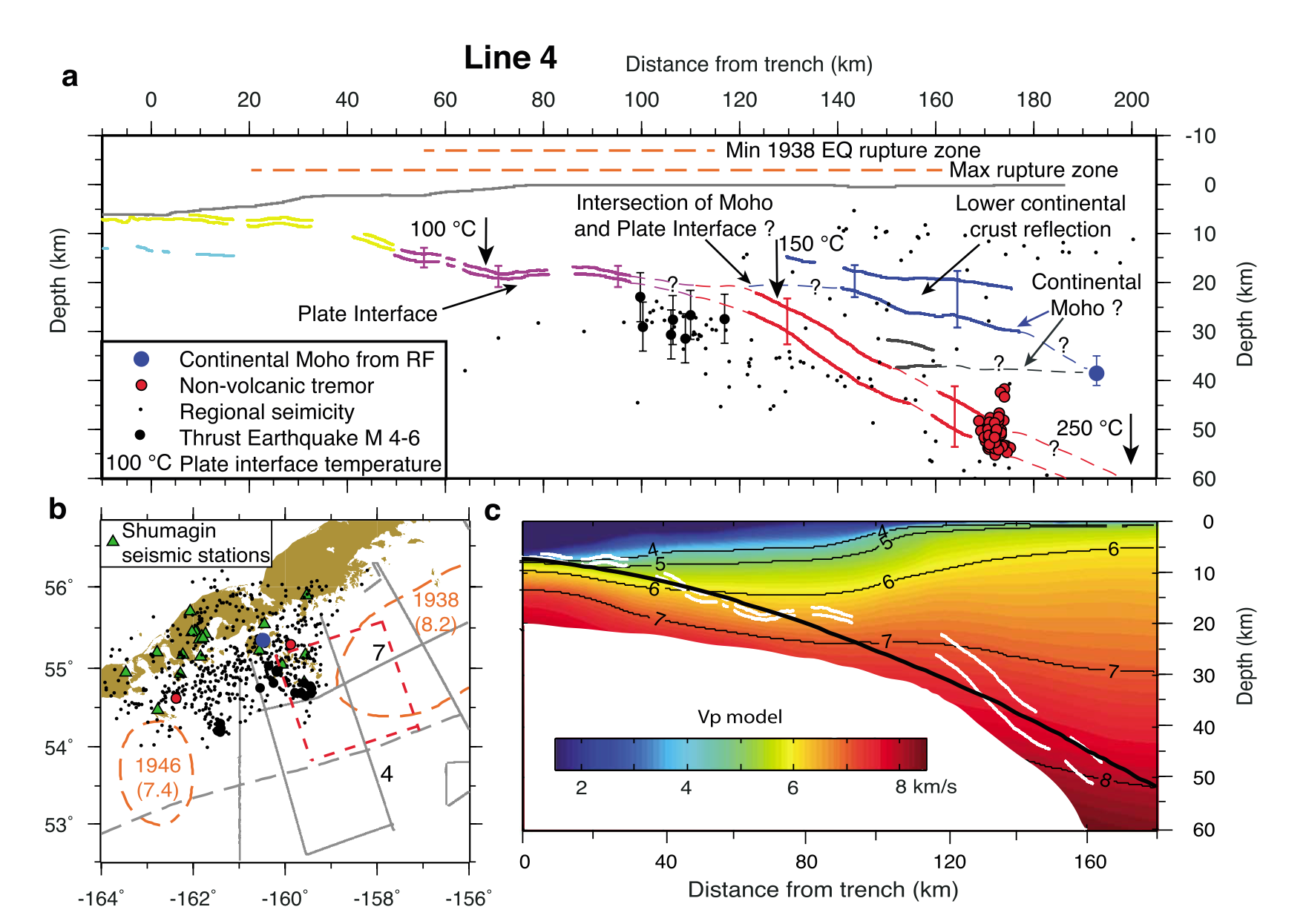
We plotted panel C onto our cross section and found an almost perfect match between Slab2.0 and the drawn megathrust. So, the black curve shown on our profile isn’t really a guess — it is one of the few areas on Earth where the location of the plate interface at depth has actually been measured!
We gain further confidence in the data by comparing the origin locations of thrust-type earthquakes, versus the Slab2 model. After all, the megathrust earthquakes should only happen on the megathrust, right?

We see that the events do fall close to the Slab2 interface, with a vertical scatter of approximately 10 kilometers. Note that our profile is strongly vertically exaggerated, so the dips indicated by the focal mechanisms don’t visually match the black curve. With no vertical exaggeration, the profile looks like this:

Some of the outliers are clearly not megathrust events, based on the allowable fault dips. If we assume that the non-outliers really are megathrust quakes, then this tells us that we can expect the larger earthquakes in this area (M > 4.5) to be basically correct in depth, on average, with a random variation of ± 10km or so.
Because the M7.3 origin is sits about 15 km above the Slab2 surface, it seems unlikely that it is just particularly poorly mis-located in depth.
This brings us back to Possibility 2: could the aftershocks of the 2020 event be badly enough mis-located in depth that they don’t actually indicate rupture crossing into the upper plate?
Let’s plot the recorded COMCAT hypocenter locations, but excluding the 2020 and 2025 time periods to avoid the unusual strike-slip structures.

First, we notice that many events have been assigned a ‘default’ depth: 5, 10, 25, etc. These default depths are assigned when there is not good enough data to estimate an actual depth; most of these events are relatively old. However, there are also a lot of events not at default depth, reflecting the current high quality of the regional seismic network. And a lot of that seismicity is in the upper plate!
Let’s think about the shallow earthquakes first. The small earthquakes located along the volcanic arc (distance ~ 90 km on the profile above) have a typical depth of less than about 15 kilometers. This is what we expect — the hotter crust in that area means that deep earthquakes can’t really happen. Small clusters of very small earthquakes at about 30 kilometers depth are also commonly seen in volcanic arcs, and probably relate to the deep plumbing system of the volcanoes. No news there.
Second, we can see that the deeper part of the subducting slab is illuminated by the earthquakes happening inside of it. This is the famous Wadati-Benioff Zone, and the data also seem pretty consistent with the Slab2.0 model. We do not see a clearly defined double seismic zone, which might again suggest that there is indeed some vertical fuzzing of the data.
Third, we see deeper earthquakes in the subducting plate along the outer rise; the point where the slab really begins to bend before subducting (d ~ 350 km). This deeper outer rise seismicity is also commonly observed in subduction zones.
Overall, the geological reasonability of the earthquake locations suggests that the seismicity in this region doesn’t suffer from extreme depth mis-location problems. So, Possibility 2 doesn’t seem particularly likely.
What about Possibility 1? Is there reason to believe that the strike-slip fault actually cuts across the megathrust fault?
In addition to the hypocenter data, the USGS releases fault slip models for most large earthquakes, which shows their best guess for the location, timing, and amount of slip that happened on a planar fault, based on seismic recordings from seismometers all around the globe. These slip models can’t be considered as direct observations, because they are inverted from data and are not unique. However, they provide additional guidance on the likely location of slip.
For the recent M7.3 earthquake, the preliminary slip model is shaped like a crescent, on the north-south plane dipping to the east. The slip reaches from 45 kilometers depth to the surface, with a maximum of about 1 meter.

We visually aligned the USGS slip models for the 2020 and 2025 strike-slip earthquakes and overlaid the data onto our profile. We then drew some colored blobs showing the areas of largest inferred slip: pink for 2020, gray for 2025. We also outlined the regions of recorded aftershocks, for comparison.

Taken together, these data sure don’t look like rupture of a fault only below or above the plate interface. Instead, it looks like the rupture areas are mostly in the upper plate, but also extend about 10 kilometers down into the lower plate.
An important point is that no good candidate fault structures are actually known to exist within the lower plate. While there is some structure to the seafloor, it is mostly aligned north-south and east-west, and certainly does not have such a shallow dip. So it seems likely that the unusual, shallowly-dipping strike-slip faults seen in the Shumagin Gap were formed in place, rather than being inherited from earlier structure. As far as we know, there is no reason to prefer upper or lower plate faulting of this particular orientation.
For this interpretation to change, some drastic changes would have to be made to all of the datasets. That’s a possibility, but we just don’t see why these data should be that untrustworthy!
What does all of this mean? We have a few thoughts.
Before these strike-slip earthquakes occurred, the observations from the Shumagin Gap all pointed toward the same thing. Early earthquake slip mapping suggested the gap might exist; later GPS measurements confirmed an area of low megathrust coupling, surrounded, or at least bordered on one side, by more frictionally stuck areas. No one predicted that large strike-slip events were likely here.
After the first strike-slip earthquake occurred, it was natural to try to fit it into the existing framework. And in fact, if the megathrust below the Shumagin Gap is creeping and the area to the east is not, then we should expect stresses to accumulate in the subducting slab that would promote right-lateral earthquakes, with slip on faults along the dip direction.

This result, and other similar modeling results, seemed to further reinforce the existing model for the area, and it also encouraged the interpretation that the earthquake occurred only in the subducting slab.
But with the second strike-slip earthquake, it seems like it is only becoming harder to believe that the strike-slip displacement is limited to being inside the subducting slab. And the stress explanation above only works for a fault in the slab: the expected direction of shear in the overriding plate is in the opposite direction!
Caveat emptor
All this being said, we have been looking at general data in a region that is pretty remote, so there is a chance that further study and a different treatment of the data would reveal a different pattern. We would love to see data that shout “this is the answer”.
However, we have not seen any compelling evidence that restricts slip to the lower plate. Instead, we have mostly read studies that assume the slip was in the lower plate, and then proceed from that assumption. In some cases, it doesn’t really matter, but in other cases, it seems very important.
To distract you from the possibility that our interpretations in this post might be a bit flimsy, here’s a picture of our two current foster kittens, Scotia and Farallon, who are sleeping off today’s vaccines. If you ask us, they look a little bit like two Aleutian fault slip models, side by side. Which raises another interesting question: do seismologists just see slip patches in every Rorschach diagram? Distraction complete.

What do you think? Is the existing data good enough to interpret directly, indicating a megathrust-crossing fault, or are there reasons to doubt? If so, how could we answer this question better? We look forward to reader corrections, comments, and new interpretations in light of this fascinating earthquake!
Responses to comments!
Reader Simon Klemperer asked for a reference for our offhand comment on earthquakes beneath volcanic arcs. We ruminated for a while about why we think there are earthquake clusters at ~30 km below volcanic arcs, and failed to come up with a reference. However, we eventually recalled making our own cross sections across Japan. Here’s an example of a cross section along the continental arc in part of Japan:

Here, we have used the JMA catalog, which provides precise locations and has a low magnitude of completeness. As discussed in the text, there are mainly earthquakes above about 15 km depth, but there are also clusters of small magnitude, deep earthquakes at 20-35 kilometers depth. We would love to have a good reference to refer to when discussing these types of events!
References:
Bai, Y., Liu, C., Lay, T., Cheung, K.F., and Yamazaki, Y., 2023. Fast and slow intraplate ruptures during the 19 October 2020 magnitude 7.6 Shumagin earthquake, Nature Communications, 14, 2015, DOI: 10.1038/s41467-023-37731-2
Bradley, K., Hubbard, J., 2025. Remarkable video captures fault slip in the Myanmar earthquake. Earthquake Insights, https://doi.org/10.62481/01cd039c
Hayes, G., 2018, Slab2 - A Comprehensive Subduction Zone Geometry Model: U.S. Geological Survey data release, https://doi.org/10.5066/F7PV6JNV.
Herman, M.W. and Furlong, K.P., 2021. Triggering an unexpected earthquake in an uncoupled subduction zone. Science Advances, 7(13), p.eabf7590. https://doi.org/10.1126/sciadv.abf7590
Hubbard, J. and Bradley, K., 2023. M7.2 earthquake offshore Alaska occurred in seismic gap. Earthquake Insights, https://doi.org/10.62481/12868997
Li, J., Shillington, D.J., Bécel, A., Nedimović, M.R., Webb, S.C., Saffer, D.M., Keranen, K.M. and Kuehn, H., 2015. Downdip variations in seismic reflection character: Implications for fault structure and seismogenic behavior in the Alaska subduction zone. Journal of Geophysical Research: Solid Earth, 120(11), pp.7883-7904. https://doi.org/10.1002/2015JB012338
Naitoh, A., Motoi, K., and Baba, T., 2025. Initial sea surface displacement of non-seismic tsunami associated with the 2020 sand point earthquake off the Alaska Peninsula, Prog. Earth Planet. Sci., 12, 42, DOI: 10.1186/s40645-025-00716-4
Santellanes, S., Goldberg, D., Koch, P., Melgar, D., Yeck, W., Crowell, B. and Lin, J.T., 2025. An unexplained tsunami: Was there megathrust slip during the 2020 Mw7. 6 Sand Point, Alaska, earthquake?. Seismica, 4(1). https://doi.org/10.26443/seismica.v4i1.1336
Senapati, B., Lindsey, E.O., Kundu, B., Panda, D., Tiwari, D.K., and Yadav, R.K., 2024. ‘Double Puzzle’ at the Shumagin seismic gap, Alaska Peninsula: intraslab strike-slip faulting loaded by lateral variations in megathrust fault friction, Geophys. J. Int., 236, 3, 1471-1483, DOI: 10.1093/gji/ggae002
Tape, C. and Lomax, A., 2022. Aftershock regions of Aleutian‐Alaska megathrust earthquakes, 1938–2021. Journal of Geophysical Research: Solid Earth, 127(7), p.e2022JB024336. https://doi.org/10.1029/2022JB024336
Zhou, Y., Wang, W., He, J., Wang, X., Pan, Z., and Zhao, G., 2022. The 19 October 2020 Mw 7.6 Earthquake in Shumagin, Alaska: An Unusual Dextral Strike-Slip Event, Pure appl. Geophys., 179, 10, 3527-3542, DOI: 10.1007/s00024-022-03001-3
Farallon??? Is this Schrödinger's cat that has already disappeared but is somehow still visible in this picture? Infinite cattiness?
PS "Small clusters of very small earthquakes at about 30 kilometers depth are also commonly seen in volcanic arcs, and probably relate to the deep plumbing system of the volcanoes. No news there." Tell me more. What is your reference for this?
Simon Klemperer
Once again Earthquake Insights shows the power of scientific communication without the filter of a 6-12 month delay bandpass imposed by publication in the modern scientific literature. Judith and Kyle are to be complimented once again on their thought-stimulating writing!
Using eQuakes to scan the Global CMT dataset, one can see many candidate structures that admit to the hypothesis that the subducting slab is tearing, on deeply biting ~N-S to ~NNW-SSE faults and/or shear zones, with right-lateral sense of movement in a direction not too different from the slab dip. There is one movement picture that makes such a pattern self-explanatory, and that is if the rate of south-directed rollback increases westward, with jumps in the rate of retreat accommodated by these newly forming slab tears. Naturally, such tears propagate ruptures upwards into the overlying crustal material, and are vitally important in hindering the lateral growth of the rupture extent of the different megathrust events that occur from time to time.
Interesting, in the hinge regions, such differential movement will result in compressive stress parallel to the arc, and the deviatoric stress axes in the shear zones facilitating the tearing process will be oriented with sigma1 plunging west, and sigma3 plunging NW. In this case ductile failure (governed by the maximum moment yield condition) predicts right-lateral strike-slip faults that deep moderately steep eastward.
Most major strike-slip faults (such as the Anatolian system) are controlled by deep structures, with surficial faults spinning as they propagate upward. This is as to be expected as they adjust to the Coulomb-Mohr Yield Condition that applies to more surficial levels.
Bottom line, thanks for drawing my attention to this.