How geologists use fault slip rates to think about seismic hazard - and why that doesn't always work
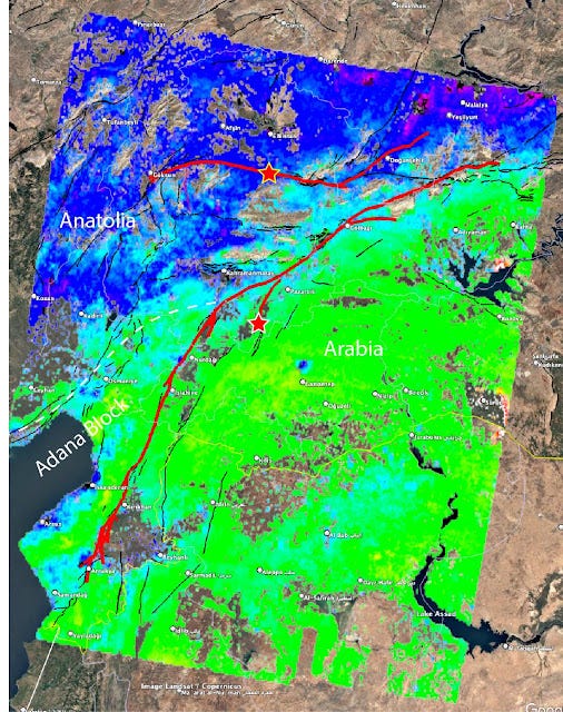
This image is remarkable, and it is a good example of how hard it is to forecast earthquakes. What is it? The image shows how the land moved over a period of six years BEFORE the earthquakes, by looking at the difference in radar scans collected by satellites.

These i…
Keep reading with a 7-day free trial
Subscribe to Earthquake Insights to keep reading this post and get 7 days of free access to the full post archives.


